Context: GAGAN Satellite Augmentation System
GAGAN is India’s Satellite-Based Augmentation System, jointly developed by ISRO and Airports Authority of India to improve navigation accuracy and safety.
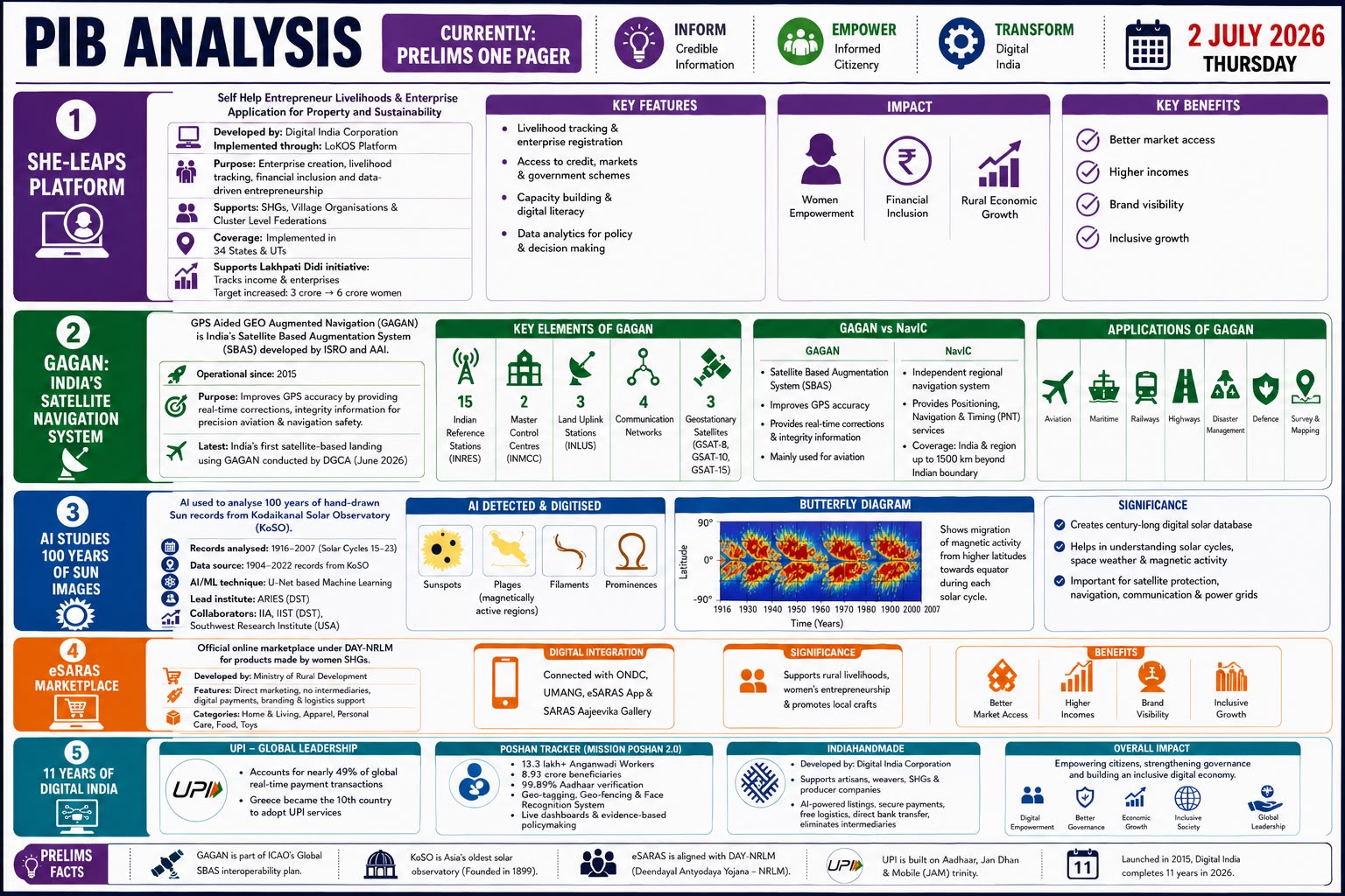
GAGAN
Full Form
Type
- Satellite-Based Augmentation System
Developed By
- Indian Space Research Organisation
- Airports Authority of India
Operational Since
- 2015
Purpose
To improve the accuracy, integrity and reliability of GPS signals.
Coverage
GAGAN covers:
- India
- Neighbouring regions
- Indian Ocean Region
How It Works
GAGAN improves GPS signals by correcting errors caused by:
- Satellite clock errors
- Ionospheric delays
- Orbital errors
- Signal distortions
Infrastructure
GAGAN uses:
- 15 Indian Reference Stations
- 2 Master Control Centres
- 3 Uplink Stations
- 3 GEO satellites
Benefits
- Improves GPS accuracy.
- Provides real-time correction.
- Enhances navigation safety.
- Supports aviation operations.
- Strengthens India’s satellite navigation infrastructure.
Applications
- Civil aviation
- Railways
- Shipping
- Road transport
- Disaster management
- Surveying and mapping
- Precision agriculture
Global Comparison
Other Satellite-Based Augmentation Systems include:
- WAAS — United States
- EGNOS — Europe
- MSAS — Japan
- SDCM — Russia
Prelims Fact
GAGAN is part of the Global Navigation Satellite System augmentation ecosystem.